
The Mendocino County Sheriff’s Office is responsible for all evacuation notices. Become familiar with the different type of evacuation notices.
Currently the plan is for Sherwood Corridor residents to exit out Sherwood Road, which runs north (exiting to Highway 101 south of Laytonville) or south, exiting to Willits. Both lanes of Sherwood Road would be available heading towards Willits. However, depending on where a fire starts, and wind direction, there could be other instructions from the Sheriff’s Office. Various additional emergency routes through private land that is not open to the public have become available for first responders entering the Sherwood Corridor. These routes may only be used by residents under the direction of the Mendocino County Sheriff’s Office. SFC recommends that all residents along Sherwood Road become familiar with Sherwood Road North to Laytonville, large and open fields in their area, and other places that might provide some safety if evacuation is complicated and difficult. Sherwood Road to Ft. Bragg is difficult to drive, even for a 4-wheel drive, and may prove to be impassible depending on conditions.
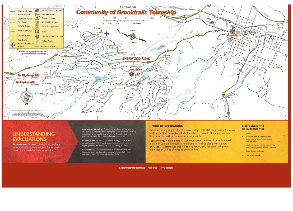
Please review the current Evacuation map provided by the Brooktrails Community Service District in order to be familiar with streets in your area. Copies of these maps may be obtained from the Brooktrails Township Fire Department.
Fires may strike at night, when you are away from home, etc. Create an evacuation plan with your family to address various situations.
Local authorities and SFC are currently working on developing additional emergency exits.
Note: All residents should register with the Mendocino County Sheriff’s Office to receive evacuation notices. Click here to register.
Neighbors working together to create a safer community